Strawberry Hill is a Nottinghamshire Wildlife Trust (NWT) nature reserve, and up until recently, records within the nature reserve and surrounding area were scarce, with no recorded archaeological work having been carried out on site before. The scarcity of records is likely a result of the extensive mineral extraction activities which were carried out before archaeological considerations were drawn into the planning process. There is a wealth of documentary evidence that indicates Strawberry Hill was once a significant landscape feature and way-marker.

Strawberry Hill has been a significant feature in the landscape since Medieval times and it appears, under different names, on numerous historic maps as well as Medieval perambulation documents. It sits on the historic boundary between the land of the abbots of Rufford and the land of the King’s manor of Mansfield. 

Recently, as part of the Miner 2 Major Veiled Landscape project, the area was subject to an archaeological survey, where NWT volunteers and a Nottinghamshire County Council archaeologist used lidar data to help guide the on-the-ground recording of previously unrecorded archaeological features. This survey enhanced our knowledge of the presence and significance of archaeological features and resources within the woodland.

LiDAR image showing earthworks within Strawberry Hill Nature Reserve

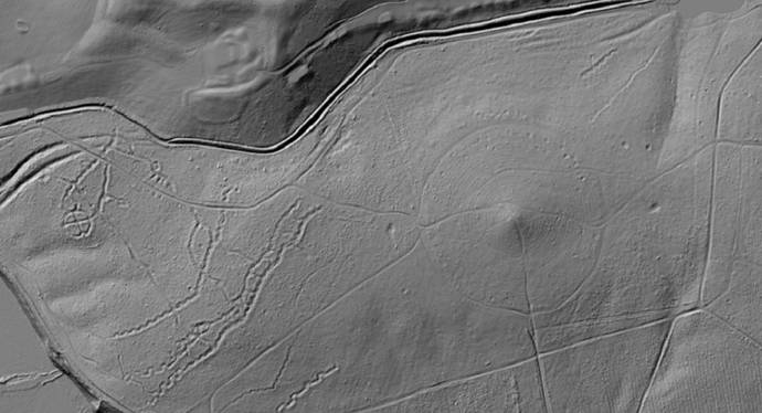
Above: LiDAR model showing earthworks within Strawberry Hill Nature reserve.

Several hollow ways survive within the woodland, one set of which is a well-used Medieval routeway that went out of use some time in the post-Medieval period. These are sections of deeply eroded ‘U’ shaped hollow ways that almost certainly represent a Medieval routeway between Mansfield and Bilsthorpe, which passes by Inkersall on the north side of the dam. This appears on the 1637 map of the Rufford Estate drawn by Bunting. Given the significance of the hill here in the landscape, historically it is possible that some of the other recorded hollow-ways may have significant age to them.

NWT volunteers and Nottinghamshire County Council archaeologist Emily Gillott standing in the contours of the Medieval hollow way

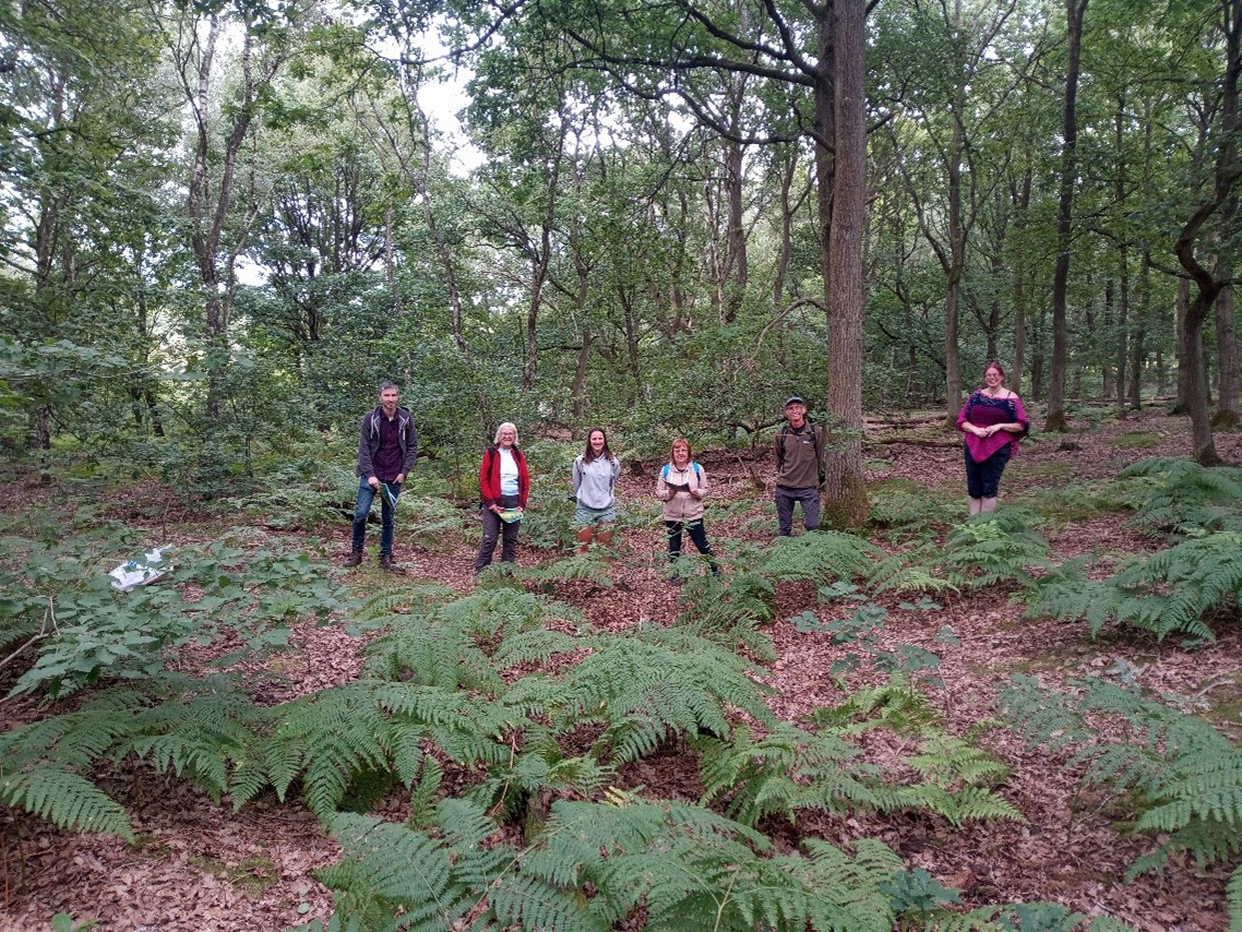
Above: Nottinghamshire Wildlife Trust volunteers and Nottinghamshire County Council archaeologist Emily Gillott standing in the contours of the Medieval hollow way.

There is also a well-preserved set of practice trenches from army training activities from the earlier 20th century This is part of a wider landscape that is characteristic of this part of Nottinghamshire, as many of the large estates turned over some of their land to military usage.  Many classic features of the trench warfare system are apparent including the classic zig-zag plan and communication lines dug to connect parallel trench sets. 

You can explore these records and the lidar survey data by searching in the database for the records below:

You can learn more information about the Veiled Landscape Project and the application of lidar here: The Veiled Landscape: Sherwood Lidar Project - Nottinghamshire Historic Environment Record

In 2015, a curious bronze object was reported to the Portable Antiquities Scheme (PAS). The PAS is managed by the British Museum and records artefacts found by members of the public. In this case, it was a coin-like token around 2.7cm in diameter and weighing 30g and found in the hinterland of a Roman town in North Nottinghamshire. It is described as having "an erotic scene depicted in relief on one side. This involves two naked figures: a young man to the left and another party of indeterminate gender to the right", while the other side is blank. It resembles a type of Roman artefact that frequently gets called a ‘brothel token’, but has the more accurate name of ‘spintria’, and may actually have little to do with brothels.

Photo of the Roman weight found in Bassetlaw, Nottinghamshire

Above: Roman weight found in Bassetlaw. Image rights holder: North Lincolnshire Museum. Image taken from: Portable Antiquities Scheme (finds.org.uk) (Record ID: NLM-45C09D).

Spintriae are found across the Roman Empire and though they are remarkably similar in style and themes wherever they are found, their exact function is still unknown. One of the more reasonable interpretations is that they were tokens that were given out in return for use of a locker in public bath houses, much like lockers at the swimming baths today. This is supported by frescoes on the walls of the Suburban Baths in Pompeii that show strikingly similar scenes. The public baths at any decent-sized town in Nottinghamshire, such as at Segelocum, would likely have featured similar imagery and perhaps a locker system that used tokens.

This find from Nottinghamshire is similar to the brothel tokens but is larger and has no numerals on the reverse, so it has been interpreted as possibly being a weight. Either way, it is a glimpse into the Roman views on sexuality in the province of Britannia.

Suitability of a sexual partner in Roman times doesn’t appear to have been based on gender, but rather on a complex set of largely unwritten social factors, such as social standing of the individuals and the nature of the companionship. It is difficult to apply modern concepts of sexual orientation to the context of Rome, and Latin had no equivalent words for ‘gay’ and ‘lesbian’ for example. But homosexual and bisexual themes feature frequently in literature and art, and on objects such as the token above. Indeed, perception of an individual’s masculinity or virility could be enhanced considerably depending on the range of relationships and sexual interactions he involved himself in.

As with so many aspects of history, we know much more about how the social framework for homosexuality related to men than to women (not surprising wherever record-making and writing is primarily the reserve of men). Famed Roman poet, Ovid, claimed that women never long for other women, romantically or sexually. However, charms and poetic graffiti written by women would suggest this is a long way from reality.

When we see the vibrant explicit frescoes in the baths of Pompeii, and the intriguing snippets of graffiti from the town’s streets, it is not hard to imagine some of the same scenes at towns like Margidunum and Segelocum in Nottinghamshire, and tokens such as the one above represent a direct link between the Roman heartland and Britannia.