February is jam packed with exciting heritage events! Here are just a few:
Saturday 1st February: ‘Are you thinking of applying for funding to support your creative development?’ Join a specialist workshop at Mansfield Museum to ‘explore applying to Developing Your Creative Practice from Arts Council England’. Booking is required and costs £5 per person. For booking and more information, visit the event page here.
Saturday 1st February: ‘Interested in a creative and/or technical career in Arts, Heritage and Culture? Come along on Family Saturday at the National Civil War Centre in Newark to enjoy some snacks and chat with their team. Learn about what it’s like to work in a theatre or museum and how to build a great CV.’ Booking is not required, find out more here.
Thursday 6th February: ‘Come and see behind the scenes and discover the secret world of the Nottinghamshire Archives! Be the first to try out their new Augmented Reality content to uncover hidden stories and images from the Archives. As part of this free tour, you will be able to interact in new ways with their collections via your own tablet or smartphone device: view a pop-up version of an Archival document directly on your device, explore 360 degree images of modern-day Nottingham blended with historic photographs to explore change over time, and listen to new audio descriptions of our Archival materials’. This event is free, but booking is required. Book your place here.
Thursday 13th February: Head down to Mansfield Museum ‘for a hands-on workshop where you'll stitch your own unique bookmark. Inspired by the rich tradition of sampler designs from the museum's collection. Perfect for all skill levels, this is a fun way to learn, create, and connect with heritage’. Tickets cost £3.50 per person and booking is required. Book your place here.
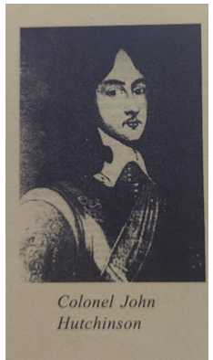
Thursday 13th February: The National Civil War Centre in Newark will be hosting the evening talk: ‘The Most Unfortunate of Kings?’. In this talk, Dr Jonathan Fitzgibbons, Lecturer in Early Modern History at the University of Lincoln, will examine if King Charles I can be blamed for his own fate or if he was, as a medal in the museum collection states, a good but unlucky King’. Tickets cost £10 per person, and booking is required. Book your place here.
Saturday 15th February: At Sherwood Forest, ‘join Sherwood’s legendary lovebirds Robin Hood and Maid Marian for this special Valentine’s Day storytelling walk deep into the heart of Sherwood Forest. Take heed of their tales of deeds and of how the history of the greenwood is intertwined with their timeless romance’. Booking is required, ticket prices range. Book your place here.
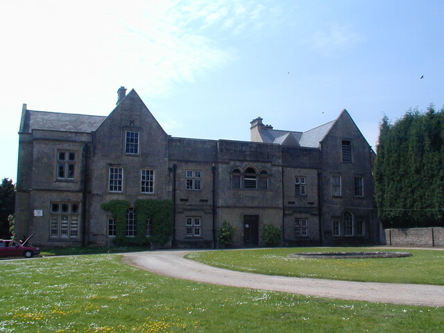
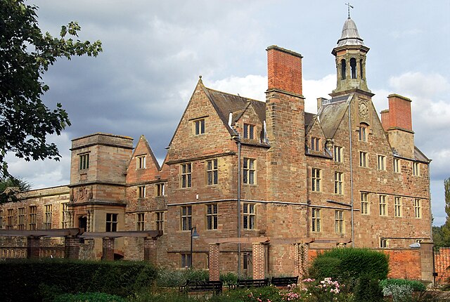
Above: Annesley Hall, ancestral home of the Chaworth-Musters family (see below).
Tuesday 18th February: Head to Mansfield Central Library where Author Nicola Webb tells the story of John Patricius (Patrick) Chaworth Musters and Mary Ann Sharpe. Born in different classes, the two love birds are sent to live a private life in Norway by his family but years later, they return to wed and take on Chaworth-Musters’ family estate. Tickets cost £3 per person and booking is required. Book your place here.
Tuesday 18th February: The National Holocaust Museum will be revealing ‘brand-new Handling Box, packed full with incredible artefacts. Explore how ordinary people became and still become refugees, by handling amazing objects that have been donated to us by Holocaust Survivors’. This event is free, and booking is not required. For more information, visit the event page here.
Wednesday 19th February: Our Historic Environment Officer Janine will be hosting a talk at Worksop Library on her wonderful book ‘Colliery Stables & the Nottinghamshire Pit Pony’. ‘With first-hand accounts from former pony drivers and freshly discovered documentary and photographic evidence, this talk delves deeply into the lives of a workforce that gave all they had. Learn how their working conditions changed over time, and how they are remembered by their former handlers. Join Janine for this fitting tribute to Nottinghamshire’s hidden heroes’. Tickets cost £3 per person and booking is required. Book your place here.
Thursday 20th - Saturday 22nd February: Head to the Workhouse and Infirmary in Southwell to take part in their event ‘Tales from the Workhouse’. ‘Write on a slate, help with the washing, learn to pick oakum. Meet our costumed characters and come and find out what life was like within The Workhouse. Listen to their stories as you encounter the inmates doing their daily jobs’. Booking is not required, and this event is free, normal admission fees to the Workhouse are still in place. For more information about the event, visit the event page here.
Friday 21st February: At the Harley Museum, Join picture frame conservator Claire Ridley to take a fresh look at the frames in their museum with a museum talk. In this talk Claire will delve into traditional and decorative gilding techniques. Using frames in our museum as examples, you will learn to identify different types of gilding and discover how gilded surfaces deteriorate and can be conserved. You will also get an up-close look at Claire’s conservation toolkit, from rabbit skin glue to gold leaf to burnishing stones. Booking is required and tickets costs vary. Book your place here.
Saturday 22nd February: ‘Bring along your archaeological finds to Bassetlaw Museum to be identified and recorded on the Portable Antiquities Scheme database’ by the Finds Liaison Officer for Derbyshire and Nottinghamshire. This event is free, but booking is required. Book your appointment here.
Saturday 22nd February: As part of the Nottingham Festival of Culture and Science, Lakeside Arts will be hosting a ‘Museum Explorers’ crafting workshop. This workshop will allow you to ‘explore the world of Iron Age art including metal work and stone carvings to make your artwork inspired by the artefacts. Create a Celtic plaque base on an Iron Age coin or a Celtic stone head from clay’. This event is free and booking is not required. For more information, visit the event page here.
Thursday 27th February: At the Bassetlaw Museum, the Museum’s new Curator, Dr Mike Galer will be talking about The Derbyshire Yeomanry in the First World War. He will explore the fortunes of this part-time territorial cavalry unit as it was mobilised and sent to Egypt, Gallipoli and then to Bulgaria. Tickets are £5 per person. For more information, visit the event page here.