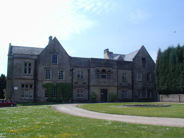
Scattered across the country are the traces of small medieval communities that disappeared from the countryside centuries ago. A deserted medieval village (DMV) refers to a settlement that was established during the medieval period in Europe, approximately between the 5th to 15th centuries AD, which has since been abandoned and left unoccupied. These were small, self-sufficient, agricultural communities, paying taxes to the feudal lords. Many of these sites are now protected as scheduled monuments.

In Nottinghamshire, LiDAR technology, aerial photography, historic records, and field survey, have so far revealed traces of 55 villages lost to time. Click here to discover their names and locations.

Have you ever seen a church in the middle of nowhere and wondered why it was built there? One local example is the ruined church of St James at Haughton. Check out the Church of St James record here.

Photograph of the deserted church of St James

Above: Ruins of the Church of St James, Haughton.

These ruins are all that remain of the church and the only indication of the medieval village that was once here. First named as Hocton in the Domesday book, it was renamed Haughton in 1316. The early Norman church was restored in the C14th and served as the parish church. Check out the deserted village of Haughton record here.

During the Tudor period, common land that belonged to the people was claimed by noblemen and enclosed, with the villagers evicted. This was the fate of the medieval village at Houghton. In 1509, William Holles enclosed a park of 240 acres. He evicted the villagers, built Houghton Hall, and annexed the church as a domestic chapel. In 1691, Houghton Hall passed into the Holles family, but they preferred to live at Welbeck Abbey and left Houghton Hall and the church to fall into ruin. By 1790, records reveal that both buildings were ‘in total decay’. The Hall was demolished in 1770 and the upper parts of the chapel were reduced in the 1960s to the ruins visible today. 

The site is visible in the LiDAR Survey of 2021. The outline of the church is clearly visible, but apart from a few sections of stone walling, there is little trace of the medieval village to be found today, in the surrounding arable landscape.

LiDAR image of a deserted church

Above: LiDAR image of the deserted church at Haughton.

LiDAR images are a good source for identifying deserted medieval villages. Earthworks (trackways, ponds, ditches, boundaries, tofts and crofts and rigg and furrow) are often the only surviving signs of occupation, and they are easier to identify in LiDAR images than through field survey.

Enclosure was a common cause of the desertion of medieval villages. In some cases, it was necessary due to changing cultivation practices at a time when sheep farming was more profitable than agriculture. This is known to be the reason for the desertion of Thorpe in the Glebe. Other reasons for population decline and desertion include famine, disease and conflict. Urbanisation was also attracting some people to migrate to towns and cities. Check out the Thorpe in the Glebe deserted Medieval village record here.

Some impacted villages did survive. Today, the village of Little Carlton near Newark, is a linear settlement, with houses built along Bathley Lane. In medieval times, the populated area was further west, close to the manor house. Today this area is farmland, but the marking of medieval trackways, sunken pathways, boundaries, house platforms, tofts, and a pond are still visible. Little Carlton is an example of a village that has either shrunk over time or shifted its central point. Check out the shrunken village of Little Carlton record here.

Map showing the shrunken village of Little Carlton

Above: The area marked in green shows the scheduled site of the shrunken village of Little Carlton.

Through the combination of modern technology and historical texts, the long-gone villages of medieval Nottinghamshire are re-emerging. Pioneering archaeological techniques might yet tell us more about their demise. At a site featured on Digging for Britain, Tephra particles were identified in soil samples taken from the deserted medieval village of East Hestlerton, in Yorkshire. This is the first direct evidence that volcanic activity in Iceland, may have caused crop failures in England in the sixth century, and perhaps resulted in the demise of some medieval villages. Could this be the case in Nottinghamshire too?

Miner2Major is a Landscape Partnership scheme, supported by the National Lottery Heritage Fund, focusing on the natural and cultural heritage of the Sherwood Forest area. It is one of the aims of Miner2Major to explore and celebrate the built heritage of its area.

Nottinghamshire County Council’s Historic Environment Officer for Buildings, Janine Buckley, delved into the country house stables of the Sherwood Forest region. Often overlooked in historical narratives, this new publication tells their story.

Book cover of 'Country House Stables of Nottinghamshire'

The horse was vital to the country estate. Stables to accommodate carriage and riding horses as well as hunters and racehorses were erected on a grand scale. Just as horses were status symbols, the buildings that housed them conveyed their owner’s status both in their external architecture and as technologically advanced buildings that restored horses back to full health after work.

Through four case studies (Rufford Abbey, Rufford Farm Stud, Park Hall and Newstead Abbey), this publication examines the form and function of country house stables, the architectural significance of the buildings, their history, and their eventual adaptation for other purposes. Discover how the buildings themselves reveal details of those who worked in them, the experience of the horses that lived in them, and the relationships between man and horse. Learn about messages found under floorboards and how the marks made by horses tell their own stories.

Printed copies of Country House Stables of Nottinghamshire are available free of charge in larger Nottinghamshire libraries and The Book Case bookshop in Lowdham and Five Leaves bookshop in Nottingham. It is also available to download as an e-book here.

Links to the Historic Environment Record:

Rufford Abbey Stables

Rufford Stud Farm Stables

Park Hall Stables

Newstead Abbey Stables

Miner2Major Logo Banner

www.miner2major.org.uk

Instagram | Twitter/X | Facebook

Miner2Major is a Landscape Partnership scheme supported by the National Lottery Heritage Fund. It encourages local communities to get involved in projects that celebrate the diverse wildlife, important habitats and rich heritage of Sherwood Forest.

Miner2Major focuses on the heart of the Sherwood Forest area from Nottingham to Ollerton, and Mansfield to Rufford Abbey, an area that has a distinctive landscape character, which is recognised and valued by local people, as well as visitors from around the world.

Sherwood Forest is famous for being the home of Robin Hood and his merry band, living deep in the impenetrable medieval forest. But was Sherwood Forest always like this? Snails found by archaeologists excavating a 2,000-year-old Roman well, tell a very different story.

In the 1970s, crop marks were identified in an aerial photo in the area now known as Wild Goose Cottage, at Lound. The crop marks revealed evidence of two Iron Age Huts and three Romano British sub-rectangular enclosures.

Photograph of the excavated well at Wild Goose CottageAerial photograph of Wild Goose Cottage

When the site was being cleared for mining in 1992, a well was discovered. The one-metre square well, lined with oak planks, was filled with household waste and soil (a common practice once wells are abandoned). Archaeologists collected soil samples from the well for paleoenvironmental analysis. The samples contained flora and fauna that lived in the well while it was operational, and soils from the surrounding area that were used to backfill it.

By sieving through these samples and extracting organic matter under the microscope, 163 species of seeds, pollen, and insects were identified. What did this evidence reveal? Firstly, the snail species present are known to prefer open habitats to dense forests. Secondly, pollens from cereals indicate open damp grasslands in the floodplain, while other species indicated drier, sandier pastures with hedged fields to the west. Finally, seeds associated with grazing animals and dung living insects suggest the keeping of livestock. This evidence enabled archaeologists to build a profile of an open, grazed landscape during the Roman times, more like today than the dense medieval forest.

The post-Roman development of Sherwood Forest is well documented. It was created as a royal hunting forest after the Norman Invasion of 1066. By the 1200’s it covered 100,000 acres. Medieval forests were carefully managed for their wood resources, but by the time of the Civil War, the forest was lacking proper management and in decline. Large areas were gifted to local aristocrats, forming the ‘Dukeries’. They profited from the sale of timber to the navy and for construction purposes. Deforestation continued with the Industrial Revolution and the two world wars. By the 1950s, the area was no longer economically viable. Forestry operations were abandoned, and wild woods began to flourish again. In 1954 Birklands was designated a site of Special Scientific Interest, leading to the creation of Sherwood Forest Country Park, a heritage site of international significance, popular for recreation and tourism.

Human activity has transformed Sherwood Forest over the centuries. Using paleoenvironmental data, archaeology, and historical records, we can develop an understanding of the evolving relationship between people and Sherwood Forest, through time.

Find out more using the links below:

Wild Goose Cottage Monument

Paleoenvironmental Sampling

The history of Sherwood Forest

Recommended additional reading:

'Caught in a trap: landscape and climate implications of the insect fauna from a Roman well in Sherwood Forest'. Archaeological and Anthropological Sciences 10:125–140. Paul C. Buckland & Philip I. Buckland & Eva Panagiotakopulu. 2018.

Miner2Major Logo BannerVisit the Miner2Major website here

Instagram | Twitter/X | Facebook

With Christmas approaching and the cost-of-living crisis continuing to bite, charities are appealing for donations to help those in need this Christmas and beyond. Thankfully, attitudes towards those in need have come a long way since Dickens introduced us to Ebenezer Scrooge.

Built in 1824, the Workhouse at Southwell stands as an exceptionally well-preserved window into Victorian attitudes towards the poor.

Photograph of the Workhouse in Southwell

Above: The Workhouse, Southwell. By DeFacto - Own work, CC BY-SA 4.0, Wikipedia.

The English Poor Law of 1834 led to the establishment of around 1800 workhouses throughout England and Wales. Built to eliminate pauperism, they effectively became prisons for the most vulnerable in society. Victorian attitudes were harsh: unsympathetic, and morally judgmental. Conditions in the workhouses were intentionally austere and unpleasant to deter all but the truly destitute. Upon entry, families were split up into male and female wings, and children separated from their parents. They lived and worked segregated lives, with no contact. Workhouse inmates slept in communal dormitories on narrow beds, with very basic bedding. They wore institutional uniforms and were put to work on gruelling physical tasks like breaking rocks, picking oakum fibres from old ropes, laundry work or corn grinding. The food provided was of very poor nutritional quality and meagre portions.

Whilst life for the 160 inmates at Southwell was undoubtedly bleak and unpleasant, there is evidence that gradual improvements were made as attitudes changed and new poor laws were passed. One major advance was the distinction made between the non-disabled ‘undeserving’ poor (the idle) and the infirm and elderly ‘deserving’ (blameless) poor, who were to be housed in an infirmary and cared for by nurses. The number of school places was expanded, and inmates began to work in the community with a view to a future beyond the walls. Decorative elements such as flower beds were introduced to create a more humane environment.

In 1929, new legislation transferred control of the workhouses to local authorities, who were required to run them as hospitals for the elderly and infirm who were unable to leave. The name was changed to Greet House, and people with social needs continued to be provided for here, until the late 1970s.

The site was purchased by the National Trust in 1997, and after years of restoration, was opened to the public in 2002. Today, the building is brought to life through the stories and objects of those who once lived here. The workhouse building has been designated as a Grade II* listed building as the most complete example of a workhouse in Britain and for its historical and social significance, representing the poor, who are largely missing from history, and the impact of poverty across the generations.

Check out the HER record here 

Pubs have been an important part of life in Nottinghamshire for centuries, not only providing refreshments but as the focus of community life. The origin of pubs can be traced back to the Roman period when ‘Tabernae' selling wine were set up along roads and in towns. In the Medieval period, Alehouses emerged. These were private homes where the householder brewed ale. The brewing process meant ale was safer to drink than water. Taverns were built to accommodate more people and to offer food, and larger Inns were built to include lodgings and accommodation for travellers. Collectively, these establishments are known as public houses (pubs).

Many old pubs are listed by Historic England or Locally Listed by local planning authorities to conserve them as an important part of our cultural heritage. More than 200 public houses are recorded in the Nottinghamshire Historic Environment Record (HER). Use this link here and enter ‘public houses’ to see the complete list.

Nottingham has a claim to the oldest surviving pub in England - the famous ‘Trip to Jerusalem’ inn carved into the rock below the castle, is said to date to 1189 AD. It is reputed to have been used as a recruitment centre for knights signing up to join King Richard I on the Crusades. The earliest parts of the timber structure date that survive today, date to the early 17th century. The pub was Grade II listed in 1952.

Photograph of Ye Olde Trip to Jerusalem Pub

Above: The famous Ye Olde Trip to Jerusalem pub

Many of our old pub buildings have historic value. They often retain original features such as timber frames, flagstone floors, and leaded windows. Their building style, construction type and materials vary. The name of the pub often reflects local history, referring to historical people, landscape features, animals, hobbies and occupations.

Pub names are often based on heraldic symbols. The most common pub name in Britain is The Red Lion, originally the heraldic symbol of King James I. Six are recorded in the Nottinghamshire Historic Environment Record (two are now domestic houses). Other heraldic symbols include Lions, Dragons, Unicorns, Griffin, and Crowns.

Examples include:

Photograph of the 18th-century Crown Inn at East Markham

Above: The 18th-century 'Crown Inn' at East Markham. Check out the HER record here

Other pub names refer directly to Kings and Queens, famous people and local aristocracy:

Photograph of the sixteenth century ‘The Queens Head’ at Newark

Above: The sixteenth century ‘The Queens Head’ at Newark. Check out the HER record here

Photograph of The Manvers Arms (Radcliffe on Trent)

Above: 'The Manvers Arms' at Radcliffe on Trent. Check out the HER record here

Other pub names can give us clues about the landscape, names such as The Willow Tree, and Bridge Tavern. Names may be based on local wildlife, such as The Black Swan or The Fox. Some tell us about the interactions between humans and animals, The Butcher and the Bull or The Jolly Angler or even domestic animals like The Greyhound. Other pub names mention local industry and pastimes: Miners, Blacksmiths, Carpenters, Gardeners, and Cricketers to name a few.

Photograph of The Old Greyhound Public House at Aslockton

Above: The Old Greyhound Public House at Aslockton. An early nineteenth-century stable and coach house. Check out the HER record here

Like the rest of the UK, Nottinghamshire has seen a decline in the number of pubs over the last couple of decades. Increased costs, changing drinking habits and the smoking ban have made running traditional pubs more difficult and resulted in the closure of many pubs. Often the buildings are converted into homes or businesses. Statutory Listing, Local Listing and Listing as Assets of Community Value (ACV) are all designed to conserve these historic buildings.